FOREST BATHS

The Water Path
The “Camí de l’Aigua” (Water Path) is a footpath that follows the courses of the rivers Noguera de Tor and Noguera Ribagorçana for around 27 km, between El Pont de Suert and the Vall de Boí. This is an old droving route and natural path, so it is a route full of history and culture and one that is highly recommended for those who love hiking. The place that we propose for forest bathing is located on the northern part of the path, in the Vall de Boí, near the Aigüestortes i Estany de Sant Maurici National Park.
It is possible to park your vehicle at the car park near the spa of Caldes de Boí, next to the L-500. The unmistakeable sound of water is already present in the parking area and will accompany you along practically the whole length of the route. These are the waters of the River Noguera de Tor, which is the main tributary of the River Noguera Ribagorçana, whose force feeds the hydroelectric power station of Caldes de Boí, which is located a just few metres below the spa, at the confluence with the River Sant Nicolau. This fluvial environment is, without a doubt, one of the highlights of the proposed route, along with the National Park.
To reach the area proposed for forest bathing, it is necessary to cross the bridge, then head towards the spa, following the left-hand path. If you have time, to your right, there is a medieval building containing the shrine of Our Lady of Caldes; this was first documented in the 11th century. Visitors are recommended to take a walk through the gardens and to enjoy its many fountains: there are 37 in total, with a great variety of flavours and mineral-medicinal properties, and they are located at different points around the spa.
Once inside the enclosure, and following the course of the River Noguera de Tor, it is necessary to head towards the Font del Ferro (Iron Fountain). You cannot miss it; you only need to follow the signs that you will find along the way. As you get closer to the fountain, the water springs are a real spectacle, especially during the spring thaw period; in fact, it is well-worth spending a little time there, at any time of the year. Having passed the Brollador de l’Isard spring and the La Sallent gully, you will note that the name of the path is no lie, because as you get closer to the Font del Ferro, you will probably see the water splashing out over a few metres, but it is still possible to pass it without much difficulty. Then, almost immediately after, you will come to a small clearing with a few wooden benches; this is an ideal place for immersing yourself in this gift of nature. At the picnic area, there is a red sign which indicates that you are at kilometre 27.
It is possible to enjoy forest bathing while doing the first part of the path, as far as the Caldes-La Farga hydroelectric power station, which you will reach after a walk of 4.6 kilometres. Much of his section is accompanied by a wooden walkway, which makes the walk even easier. Of course, for those who want to follow the route to its end, that is easy; you only have to continue along the water path until you get to Boí and Barruera, and then carry on towards El Pont de Suert (with a total net variation in altitude of 650 metres). If not, and you want to return to the start, it will be necessary to go back along the same route.
From the very beginning, you will walk through lush, humid and shady forest, where the temperature, water and humidity help moss to proliferate on many surfaces, including stones and tree roots. In doing so, it creates magnificent scenes that produce what we might call a typical enchanted forest image, in which each little corner could hide incredible surprises. There is certainly so much life that it is almost impossible to take everything in at first glance! Along the trajectory, you will find some really large trees, some of which are so close to the water that it seems as though their roots are submerged in the River Noguera de Tor. There are also pine groves, small meadows and oak groves, together with riverside and aquatic vegetation. Taken together, they offer a combination of scenery that makes the route highly attractive. One good way of experiencing this gift of nature is to observe it without haste, and to let your body be impregnated by the volatile substances emitted by the plants. You should open up your senses with the intention of connecting with this space and accept the invitation to slow things down and just enjoy the experience. Everyone can accept the invitation and interact with nature, making their own, personal, connection with it. Forest bathing does not involve any specific master formula; each person can participate and create their own particular relationship with the environment, feeling more secure and improving their personal wellbeing. On many occasions the practice of embracing a tree has been related to the forest bathing, but whether you do this, or not, is a private decision for each participant. This is never an essential ingredient of forest bating, nor for enjoying nature, or for more or less impregnating yourself with the atmosphere of the forest. Being consciously present of the moment that you are experiencing is a way of accepting the invitation and letting yourself be surprised by the life that is hidden amongst the trees.
One last detail is that following the Water Path is totally incompatible with the passage of motor vehicles. You could not ask for more!
The space for forest bathing
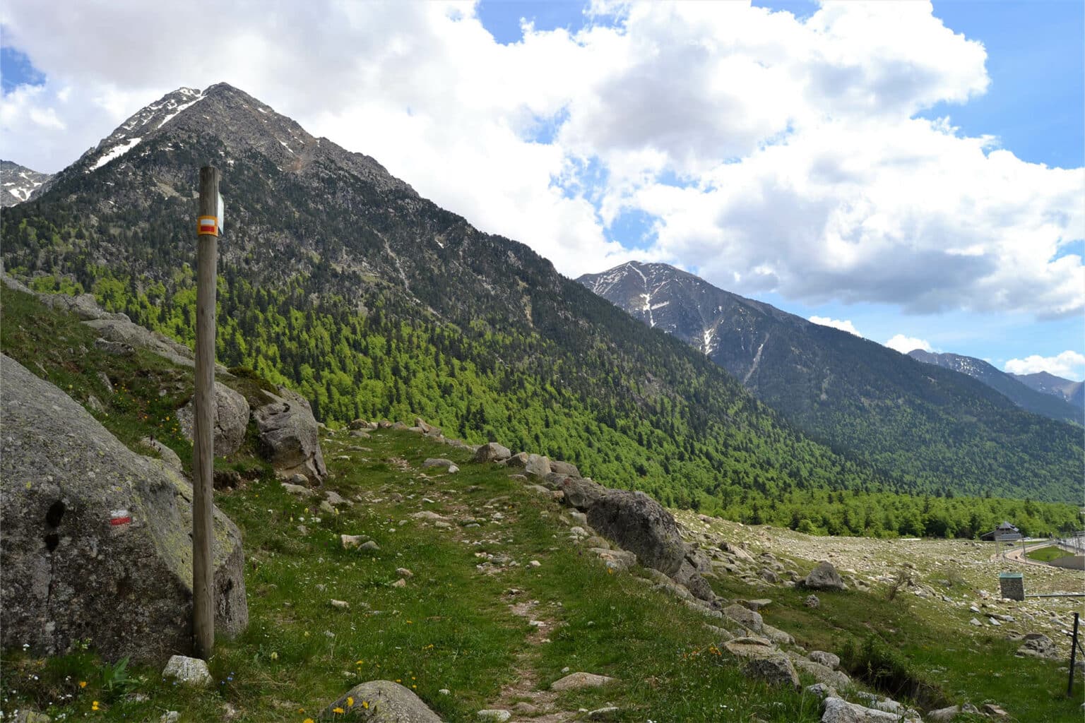
The Water Path is located at the foot of the Aigüestortes i Estany de Sant Maurici National Park. Its origins are closely related to the action of the Quaternary glaciers. When the glaciers flowed down through these valleys, they intensely eroded the landscape, creating the characteristic U-shaped profile of glacial geomorphology, leaving valleys headed by cirques, with vertical walls and high crests, as well as hundreds of pools and ponds, ravines, narrow gorges. They have created the unique “twisted waters” of these rivers and streams which make their way through the rugged landscape of the Pyrenees. The best way to enjoy this marvel is by walking, and by doing this in a leisurely way, while practising forest bathing.
The route enters deep inside this beautiful alpine valley, where the fluvial environment and the riparian woodlands coexist with woodland populated by beech (Fagus sylvatica), fir (Abies alba), mountain ash (Sorbus acuparia) and box (Buxus sempervirens) trees. The riparian forest, which is found in the upper course of the rivers, is thick and known as a gallery forest, due to the way in which the tree branches characteristically spread across the rivers. The headwaters of the rivers have their own typical trees, which include the poplar (Populus nigra) and ash (Fraxinus excelsior), amongst others. The coolness is very evident here, throughout practically the whole year, as is the humidity. As a result, you will find an abundant undergrowth formed by bryophytes (Bryophyta), which are more commonly known as mosses, ferns (Polypodiopsida), and ivy (Hedera helix), etc. Extensive areas of shade also abound in the humid, leafy forest, as do other elements which are typical of mature stands: dead, fallen or remaining trunks, with wood in different phases of decomposition, and trees of different ages and sizes.
If you decide to continue along the route beyond the hydroelectric power station, you will see that in this very rich forest, there are also Scots pines (Pinus sylvestris), ash (Fraxinus), poplars (Populus alba) and common hazels (Corylus avellana). The mixture between deciduous trees and those with perennial leaves is quite exceptional and provides magnificent palettes of greens and browns, which change colour and vary in appearance according to the time of year, while it must not be forgotten that in winter, everything may be covered by a thick blanket of snow.
Wikiloc: Camí de l'Aigua | Alta Ribagorça (turismealtaribagorca.cat)
Map: https://www.turismealtaribagorca.cat/sites/default/files/cami_aigua.pdf


