Route from the water paths to the dry lands – Tarrés
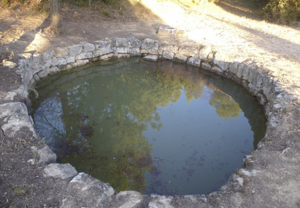
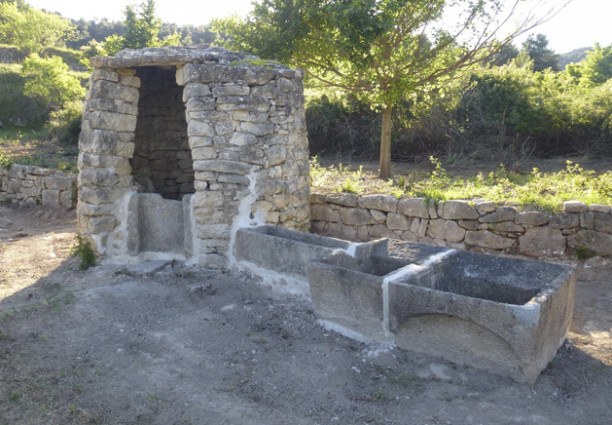
This is a circular, signposted route that runs through the municipality of Tarrés and connects together a number of public and private heritage elements associated with dry-stone building and the use of water: pools, wells, cisterns, water tanks, springs, washing places, etc.
Until the middle of the 20th century, the majority of village people used to work in the country with animals. They therefore constructed these heritage elements in order to store water - which, above all, was collected when it rained - and used it to allow both themselves and their animals (horses, mules, asses, dogs, etc.) to drink during their long working days. Having water in the field was also essential for sulphating vines, which provided the main crop grown in this municipality. Furthermore, where there were wells or storage tanks, there also tended to be enough water to irrigate the land and to allow vegetable gardens.
Part of the route also runs through the protected natural space of the Valley of Vinaixa, which is one of the Natural Spaces of Western Catalonia. It runs through fields of olives, vines, and almonds and fields of cereals that form mosaics with woods of Aleppo pine and evergreen oak, which provide abundant shade. It crosses various hollows and valleys and then heads up to the top of ridges and high plains that stand at an altitude of over 600 metres.
This is an itinerary with climbs and descents which can be followed by bicycle, by 4x4 vehicle, on foot, or on horseback. It has a total distance is 14.6 km, which can be shortened or broken down into various sections.
We hope that you enjoy the route and use it to discover the rich dry-stone and water heritage of this area. These are distinctive features, closely associated with the small-holder farmers of Tarrés and Les Garrigues.
* You can download the route at: HTTPS://CA.WIKILOC.COM/RUTES-BTT/ELS-CAMINS-DE-LAIGUA-AL-SECA-11497799
For more information: Consell Comarcal de les Garrigues
Pictures